
MILESTONES
Four Milestones from the ancient road between London and Hastings survive within Farnborough. They are all now listed monuments.
Three are on what became the Turnpike route, at Locksbottom, Farnborough and Green Street Green. The fourth is in Tubbenden Lane, the road leading from Farnborough to Orpington.
From the dates given (see below), the one in Tubbenden Lane is the original monument, the other three are nineteenth century replacements.
The local map of 1799 shows an earlier Milestone 15 being located on the original turnpike route on Old Hill. This became redundent when the route was changed to go through Green Street Green, and the stone is now lost.
The below descriptions all refer to the New Cross turnpike of 1718, however the Bromley to Sevenoaks section was not established until 1749.
Milestone 13, Hastings Road, Locksbottom (north side)
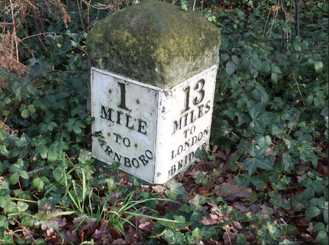 |
Milestone at TQ 46 NW 5/504 TQ 4286 6514 Milestone. Early C19. Limestone milestone with rounded top and inscription plates. One plate reads 13/MILES/TO/LONDON/BRIDGE, the other 1/MILE/TO/ FARNBORO(UGH). Located on the New Cross Turnpike road of 1718. |
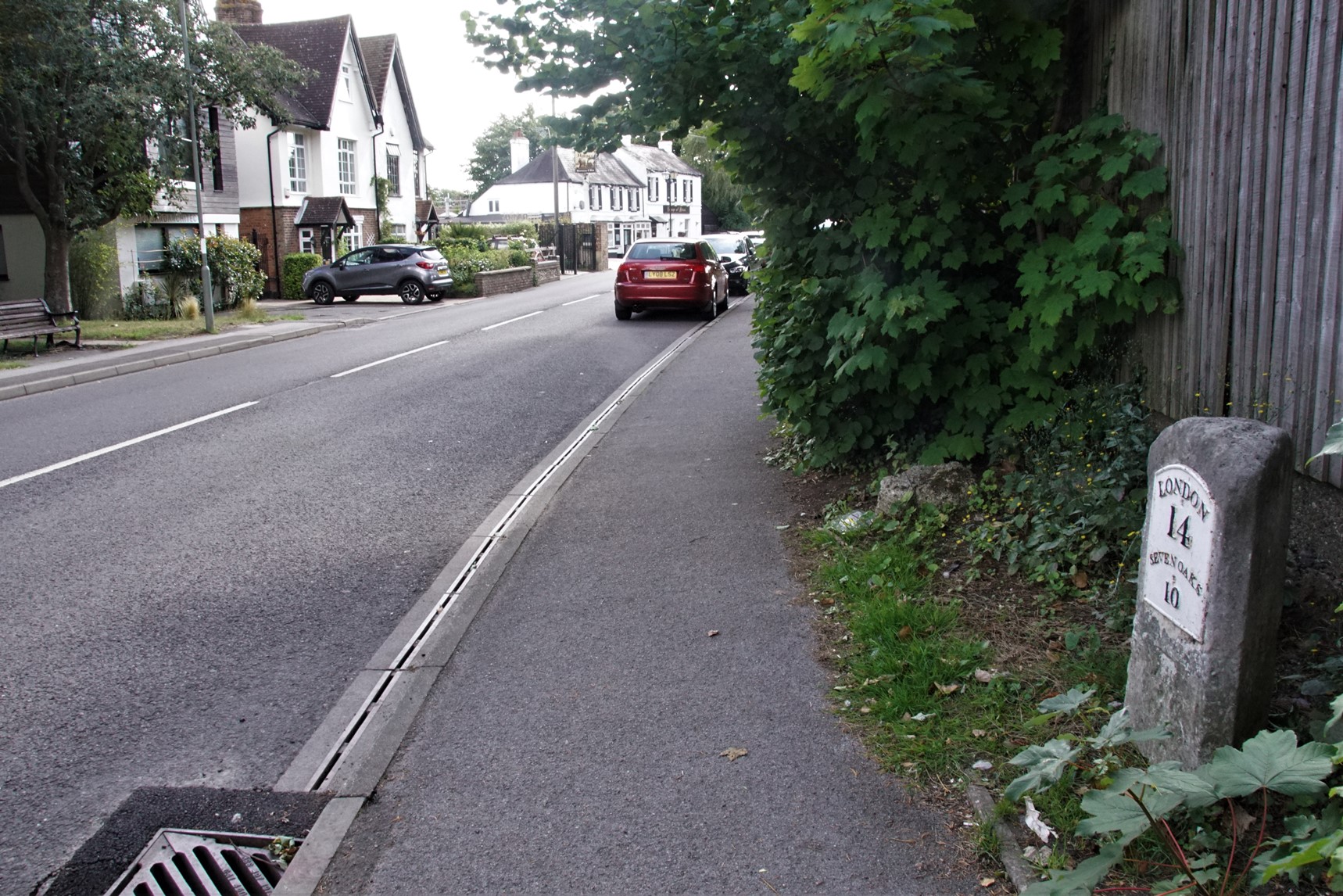
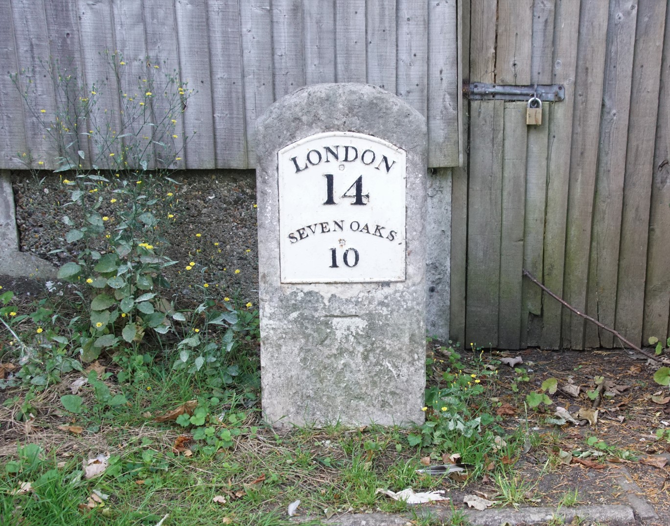
Milestone 14, High Street, Farnborough (south side)
Milestone adjacent to TQ 4364 SE 12/308 Electricity Sub StationMilestone. Early/mid C19. Limestone.
Thin, rectangular milestone with plate which reads LONDON/14/SEVENOAKS/10. Located on the New Cross Turnpike road of 1718.
 |
 |
Milestone 15, Green Street Green
Milestone at junction TQ 46 SE 10/300 of
Sevenoaks Road with Farnborough Hill Milestone. Early/mid C19. Limestone.
Thin, rectangular milestone with plate which reads SEVENOAKS/9/LONDON/15. Located on the New Cross Turnpike road of 1718.
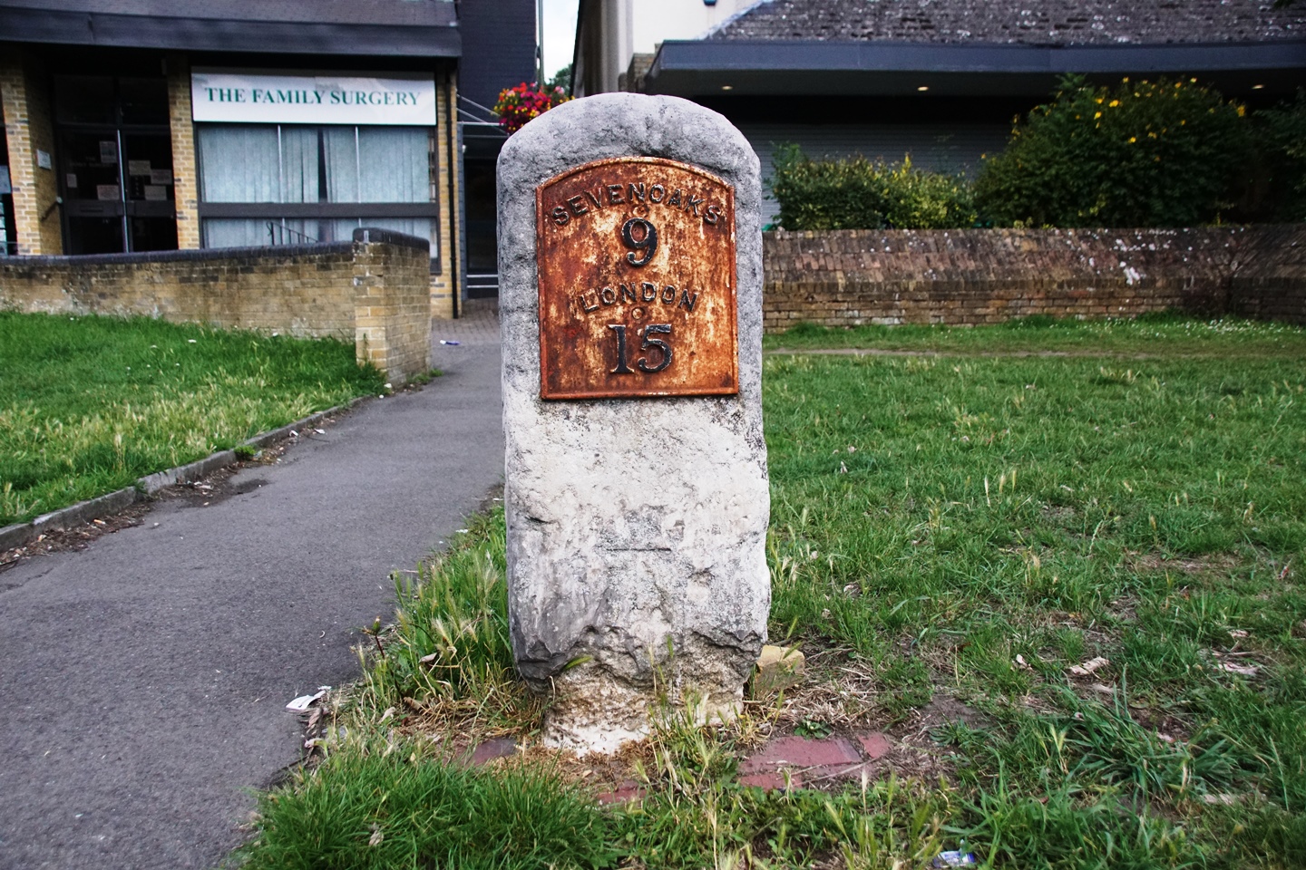 |
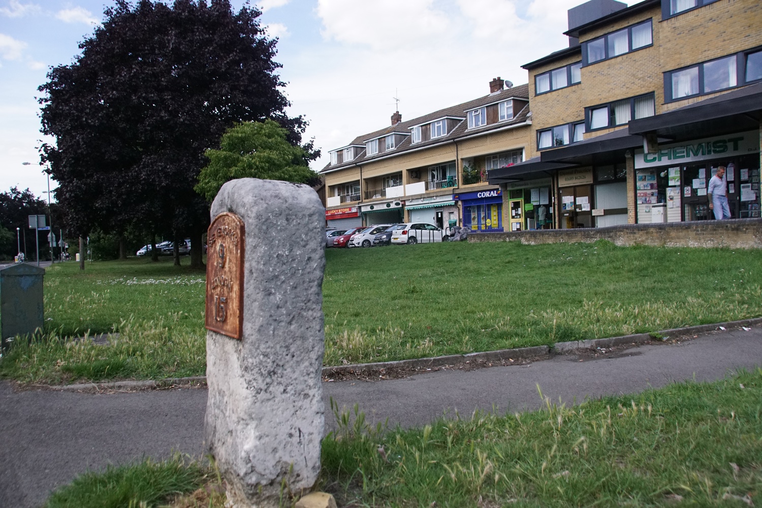 |
This milestone is located on the revised route for the turnpike, that came into use from about 1800. There is no surviving evidence of a milestone on the original route that used Old Hill.
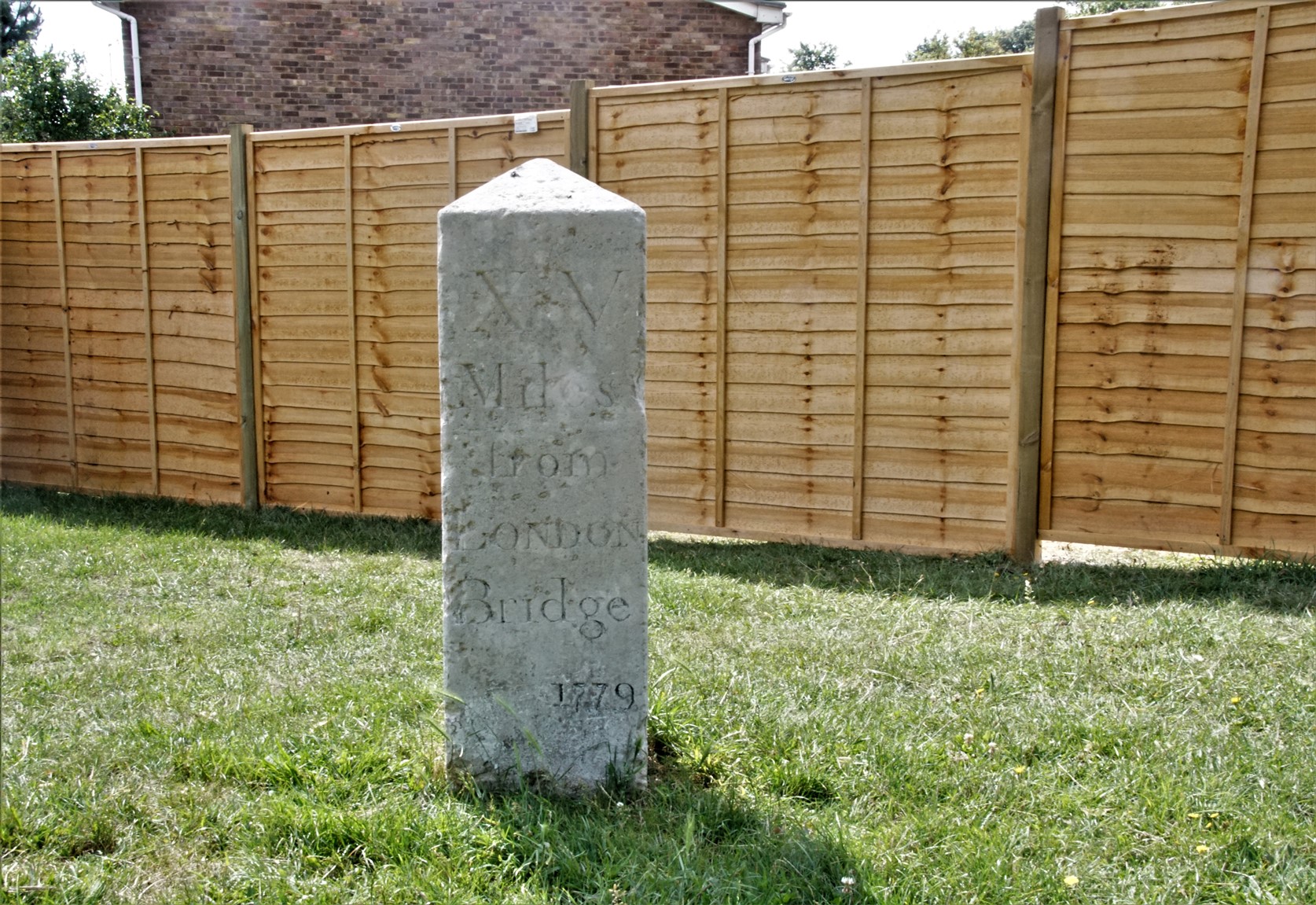
Milestone Tubbenden Lane (south side)
Milestone at corner TQ 46 NE 9/401
of Dalton Close and Tubbenden Lane.Milestone. Dated 1779. Limestone. Square plan.
Pyramidal top; inscribed XV/ MILES/FROM/LONDON/BRIDGE; date 1779 inscribed beneath. Located on the New Cross Turnpike road of 1718.
 |
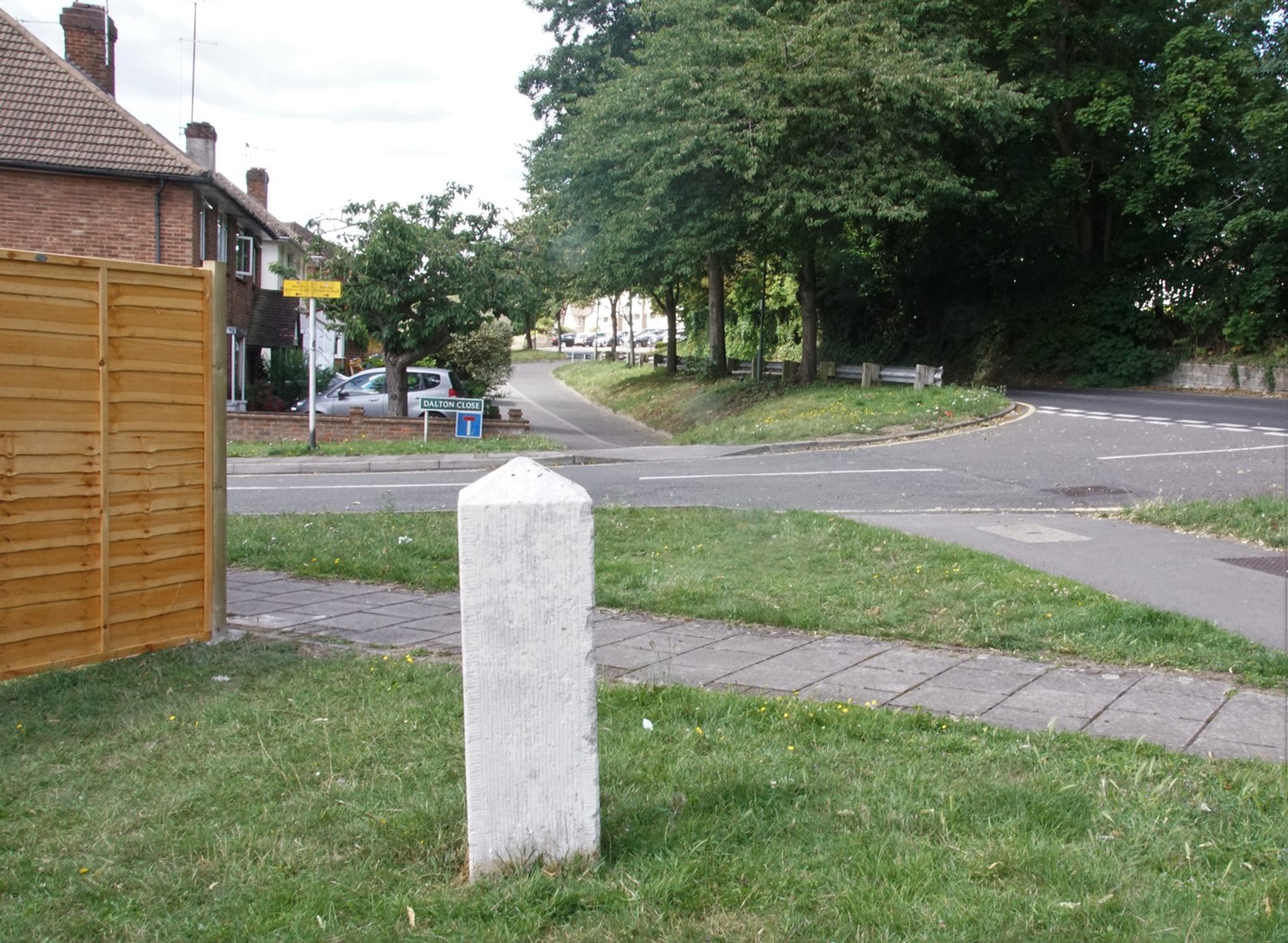 |
The location was formerly the entrance to the Tubbendence estate, and is marked on the second map on the Tubbendence page. The road shown is called Dalton Close, after George Dalton, a 16th century owner.
Nick Reynolds
TURNPIKE
About Milestones
The Romans laid good metalled roads to move soldiers and supplies quickly across their Empire: they measured distance to aid timing and efficiency, possibly marking every thousandth double-step with a large cylindrical stone. 117 still survive in the UK.
Roman Milestone, Cumbria
The Latin for thousand was ‘mille’ and the distance was 1618 yards; the eventual British standard mile was 1760 yards, although ‘long’ miles also existed into the 19th century.
After Roman times, roads developed to meet local community needs: in 1555, an Act of Parliament made local parishes (or often townships in the North) responsible for their upkeep and boundary markers became important. In 1697, the Justices were ordered to erect guideposts at cross-highways and on the moors. At this time, travel by road was slow and difficult. The sunken lanes became quagmires in wet weather and occasionally both horses and riders were drowned. It took 16 days to cover the 400 miles from London to Edinburgh.
So Turnpike Trusts were set up, by Acts of Parliament, from 1706 to the 1840s. Groups of local worthies raised money to build stretches of road and then charged the users tolls to pay for it. The name ‘turnpike’ comes from the spiked barrier at the Toll Gate or Booth. The poor bitterly resented having to pay to use the roads and there were anti-turnpike riots.
From 1767, mileposts were compulsory on all turnpikes, not only to inform travellers of direction and distances, but to help coaches keep to schedule and for charging for changes of horses at the coaching inns. The distances were also used to calculate postal charges before the uniform postal rate was introduced in 1840. At the height of the turnpike era, there were 20,000 miles of roads with milestones.
From the 1840s, rail travel overtook road for longer journeys and many turnpike trusts were wound up. In 1888, the new County Councils were given responsibility for main roads and rural district councils for minor routes. As faster motorised transport developed so the importance of the milestones waned.
‘Milestone’ is a generic term, including mileposts made of cast iron. Such waymarkers are fast disappearing; around 9000 are thought to survive in the UK. Most were removed or defaced in World War II to baffle potential German invaders and not all were replaced afterwards. Many have been demolished as roads have been widened, or have been victims of collision damage, or have been smashed by hedge-cutters or flails.