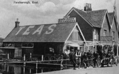

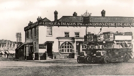
LOCKSBOTTOM
Locksbottom lies in a slight hollow, or bottom, just over 12 miles south of London on the route to Tonbridge and less than a mile from Farnborough village, an important stopping place on the London road. From at least the 17th century there has been a coaching inn here - now called Ye Olde Whyte Lion. The area alongside the main road in the northerrly direction is known as Farnborough Common.
But the name Locksbottom probably did not exist before the 1700s, and almost certainly derives its name from John Lock. He first appears in the Land and Window Tax records in 1766, when he was assessed for 14 lights (windows). His name also appears as assessor for Land Tax in 1767. He owned land in the area and lived in a farmhouse originally called Chalk Farm, but later called Farnborough Lodge. This still remains today just north of the inn. Over the years the name gained acceptance as a single word —Locksbottom.
Its principle importance since the early nineteenth century has been as the location for Farnborough Workhouse, which evolved over time to become Farnborough Hospital. This is now the location for the Princess Royal University Hospital. The history of the workhouse and hospitals is described in further pages on this website, see the menu to the right.
Ordnance Survey Maps
Here are extracts from Ordnance Survey maps from 1809 through to 1950. They are copyright Ordnance Survey, and are downloads from the National Library of Scotland website Click on images to enlarge.| One Inch to the mile, surveyed c 1805 published 1809 |
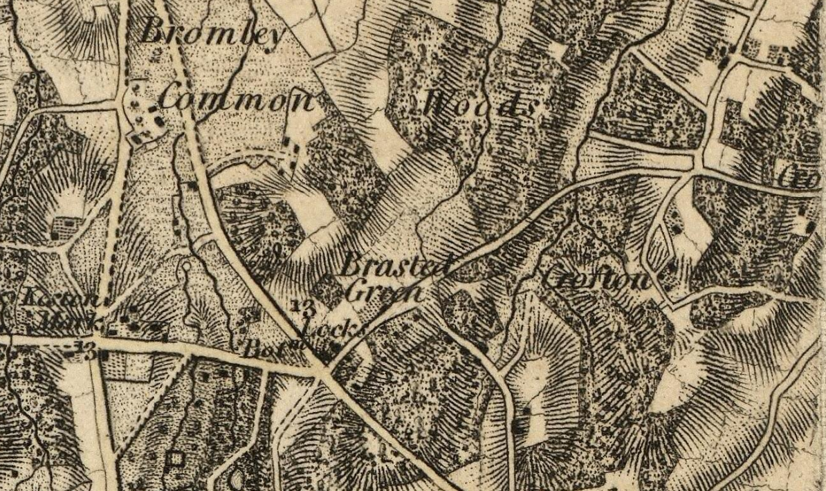 |
| At this time the area was seemingly known as Brasted
Green, with its later name Locksbottom after its resident
John Lock not yet established. The workhouse is not
shown as it was not built until the 1830s. |
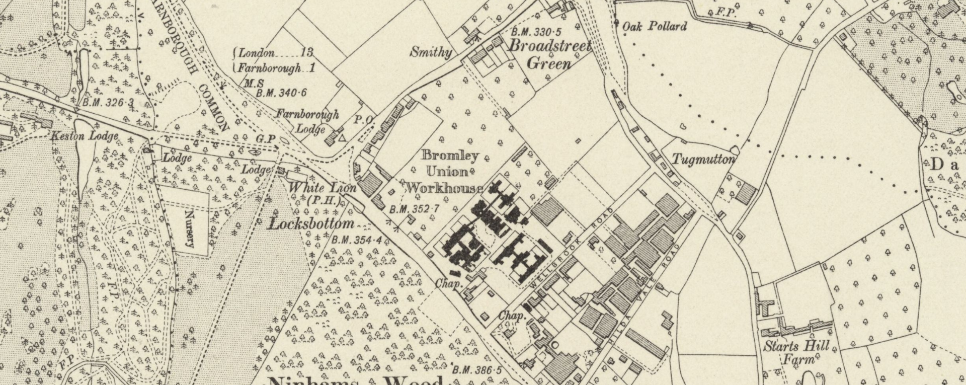
| Six Inches to a mile, surveyed 1862-1868, published 1870 |
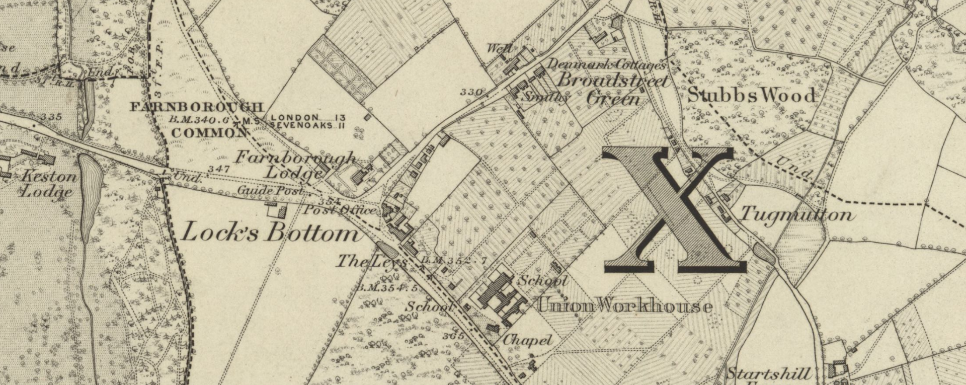 |
| By now the workhouse has been built alongside the main turnpike road.
But otherwise the area
is sparsely populated, given over mainly to farming.
Farnborough Lodge is marked adjacent to the crossroad. |
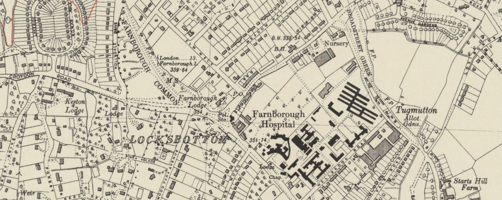
| Six Inches to a mile, revised 1908, published 1910 |
 |
| In this revised map, the workhouse has expanded
considerably in size, but this apart, Lockbottom is little
different from the first map above. |
| Six Inches to a mile, revised 1948, published 1950 |
 |
| The further forty years up to the postwar period have
seen significant changes. The Farnborough Park and
Keston Park estates have by now been built, and as a
consequence Farnborough Lodge now retains just a small garden
plot. There has also been further new residential housing
alongside Crofton Road leading north-east toward Orpington.
The workhouse has evolved into a hospital and has expanded further. |
| Here is an image from Google maps, click for a dynamic Google maps enlargement |
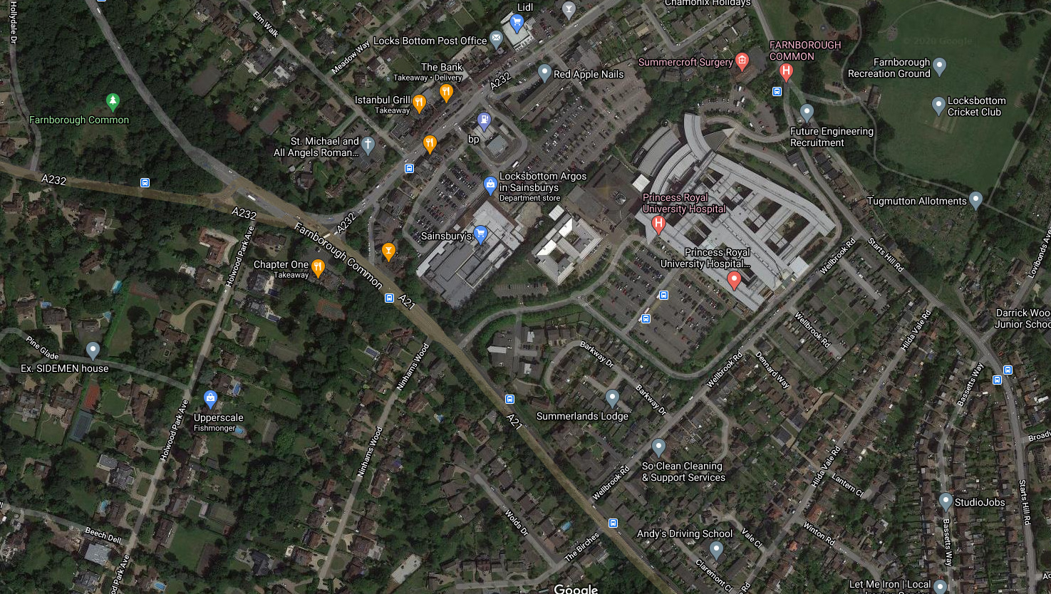 |