
MILESTONES AND COALTAX POSTS
There are four milestones and five coaltax posts listed within the Farnborough and Crofton Ward, all at Grade ll. The Coaltax posts are all in Green Street Green.
Milestones in Farnborough
Four Milestones survive within Farnborough, and they are all now listed monuments. Three are on what became the Turnpike route, at Locksbottom, Farnborough and Green Street Green. The fourth is in Tubbenden Lane, the road leading from Farnborough to Orpington.From the dates given (see below), the one in Tubbenden Lane is the original monument, the other three are nineteenth century replacements.
The local map of 1799 shows an earlier Milestone 15 being located on the original turnpike route on Old Hill. This became redundent when the route was changed to go through Green Street Green, and the stone is now lost.
The below descriptions all refer to the New Cross turnpike of 1718, however the Bromley to Sevenoaks section was not established until 1749.
Milestone 13, Hastings Road, Locksbottom (north side)
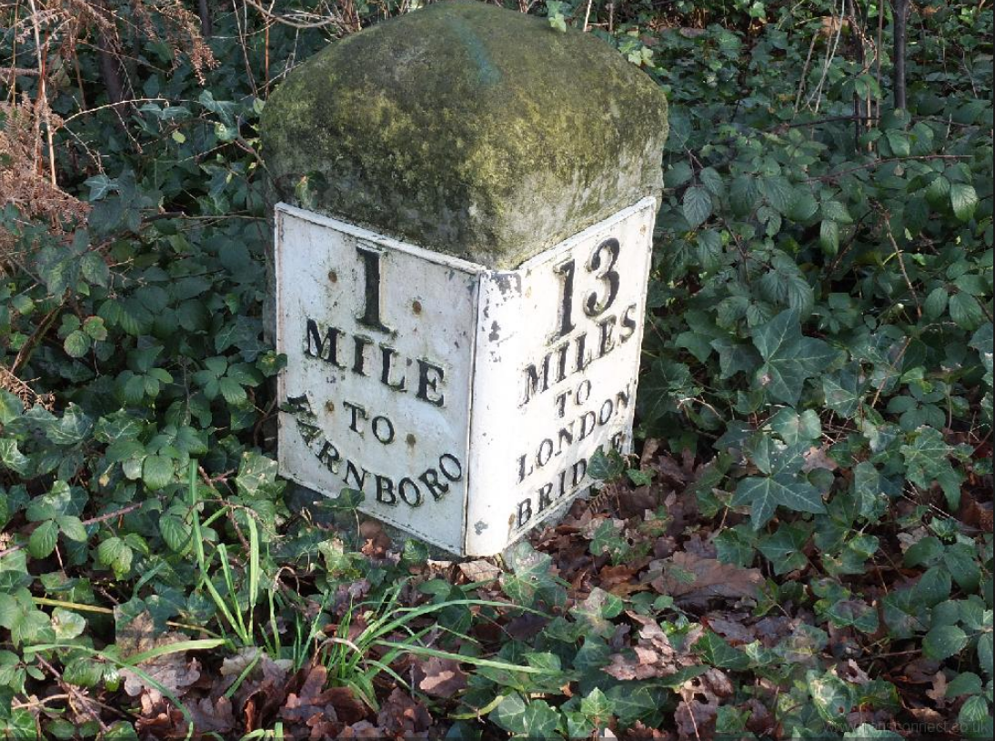 |
Milestone at TQ 46 NW 5/504 TQ 4286 6514 Milestone. Early C19. Limestone milestone with rounded top and inscription plates. One plate reads 13/MILES/TO/LONDON/BRIDGE, the other 1/MILE/TO/ FARNBORO(UGH). Located on the New Cross Turnpike road of 1718. |
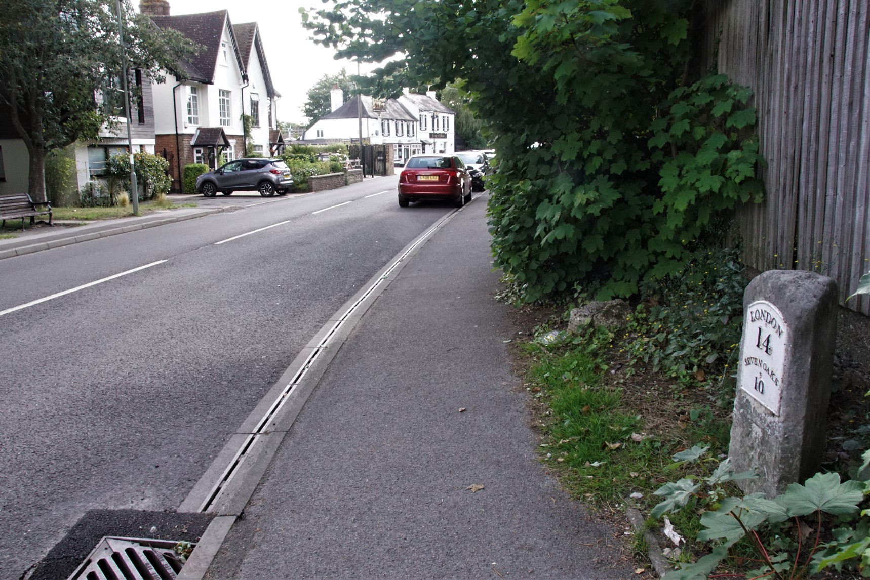
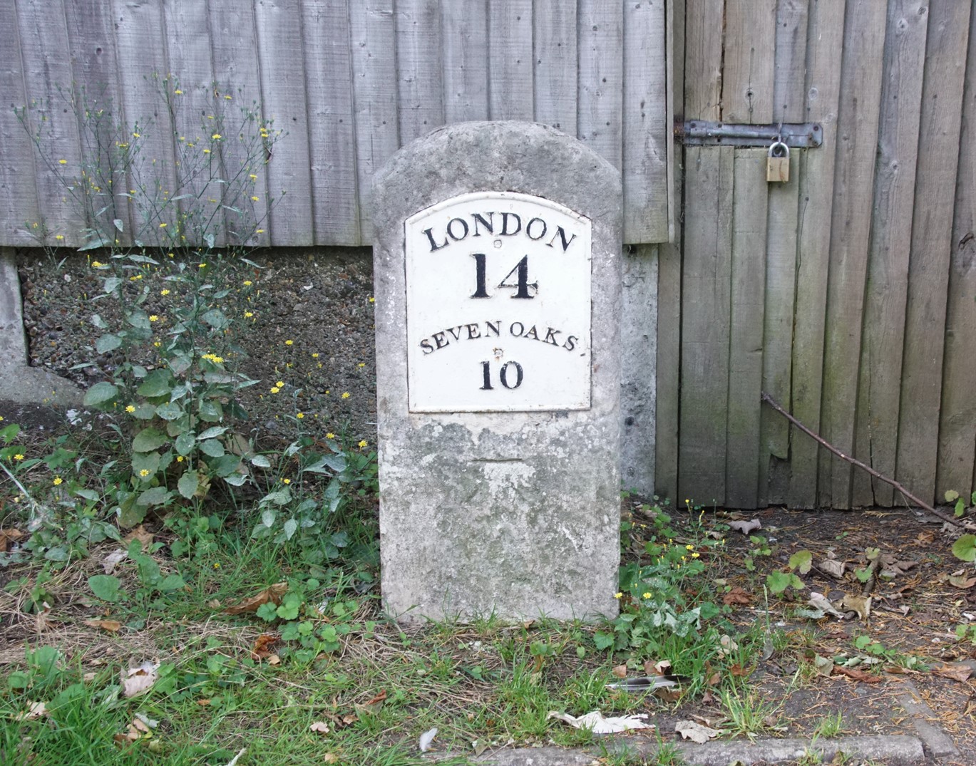
Milestone 14, High Street, Farnborough (south side)
Milestone adjacent to TQ 4364 SE 12/308 Electricity Sub StationMilestone. Early/mid C19. Limestone.
Thin, rectangular milestone with plate which reads LONDON/14/SEVENOAKS/10. Located on the New Cross Turnpike road of 1718.
 |
 |
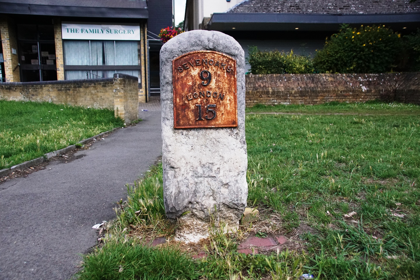
Milestone 15, Green Street Green
Milestone at junction TQ 46 SE 10/300 of
Sevenoaks Road with Farnborough Hill Milestone. Early/mid C19. Limestone.
Thin, rectangular milestone with plate which reads SEVENOAKS/9/LONDON/15. Located on the New Cross Turnpike road of 1718.
 |
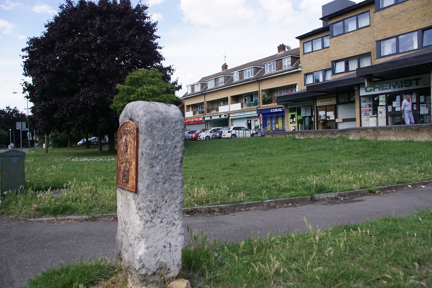 |
This milestone is located on the revised route for the turnpike, that came into use from about 1800. There is no surviving evidence of a milestone on the original route that used Old Hill.
Milestone Tubbenden Lane (south side)
Milestone at corner TQ 46 NE 9/401
of Dalton Close and Tubbenden Lane.Milestone. Dated 1779. Limestone. Square plan.
Pyramidal top; inscribed XV/ MILES/FROM/LONDON/BRIDGE; date 1779 inscribed beneath. Located on the New Cross Turnpike road of 1718.
 |
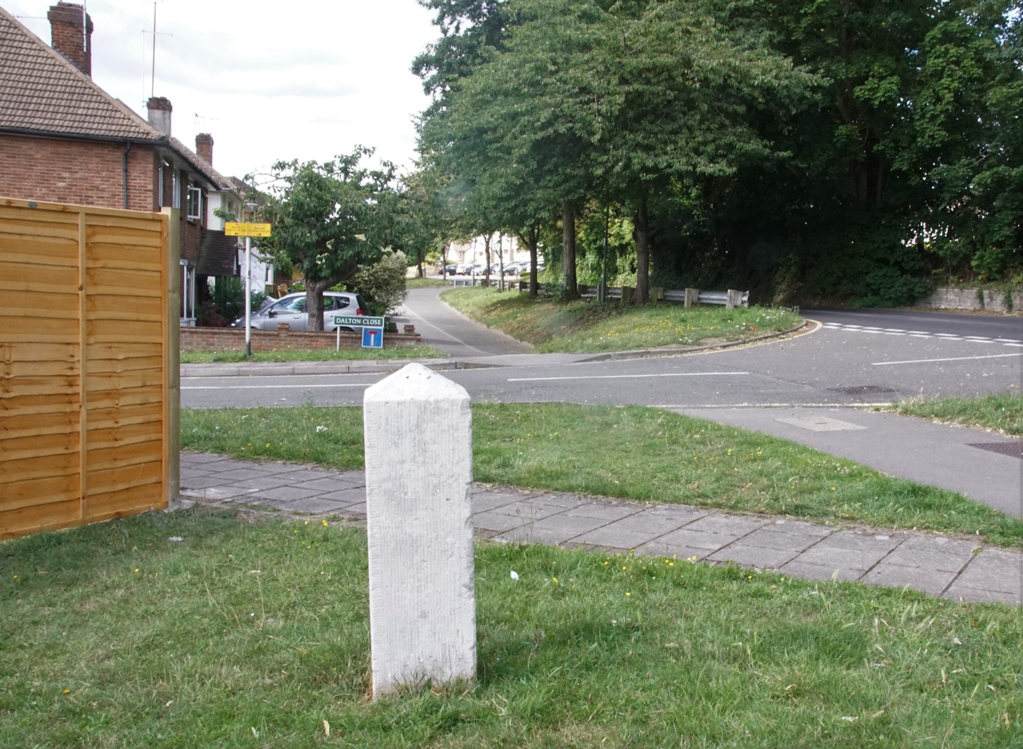 |
The location was formerly the entrance to the Tubbendence estate, and is marked on the second map on the Tubbendence page. The road shown is called Dalton Close, after George Dalton, a 16th century owner.
CoalTax Posts
in Green Street Green
There are nine coaltax posts in the Borough of Bromley, of which five
are in the Farnborough area, all at Green Street Green.
The tturnpike route changed in the 1830s, and both Old Hill and the
main road through Green Street Green would have been considered part of the turnpike.
These five are detailed
below.
For a full list see
https://orp.org.uk/coalposts/See also this page at https://www.bromley.gov.uk
By way of commemoration there is a modern road named Coal Post Close just off the High Street, see photo at the foot of this page.
For more information about the origin and purpose of Coaltax posts see the foot of this page.
 |
 |
| 191
TQ4549163255 Junction of Old Hill and Cudham Lane |
192
TQ4555563328 Roundabout, Rose and Crown |
 |
 |
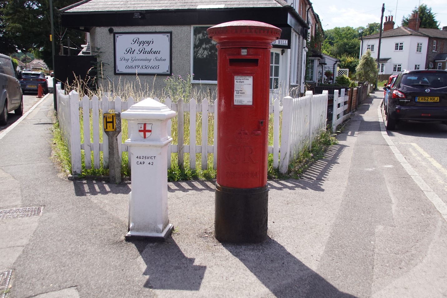
| 193 TQ4559163484 Green Street Green High Street |
194 TQ4557363890 High Street / Farnborough Hill |
 |
 |
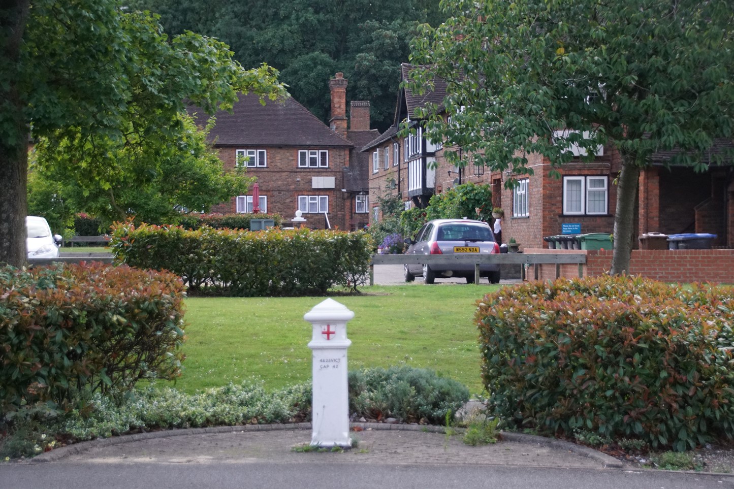
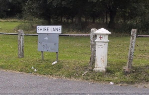
| 195 TQ4551164359 Junction Sevenoaks Road / Shire Lane |
Modern road named Coal Post
Close, off the High Stree, Green Street Green |
Follow these links to go to the entry for each post on the Historic England website.
COAL TAXPOST 191 AT JUNCTION WITH CUDHAM LANE
List Entry Number: 1186817 Heritage Category: Listing Grade: II Location: COAL TAXPOST AT JUNCTION WITH CUDHAM LANE, OLD HILL, ORPINGTON, Bromley, Greater London Authority
COAL TAXPOST 192 OUTSIDE THE CENTRAL SERVICE STATION
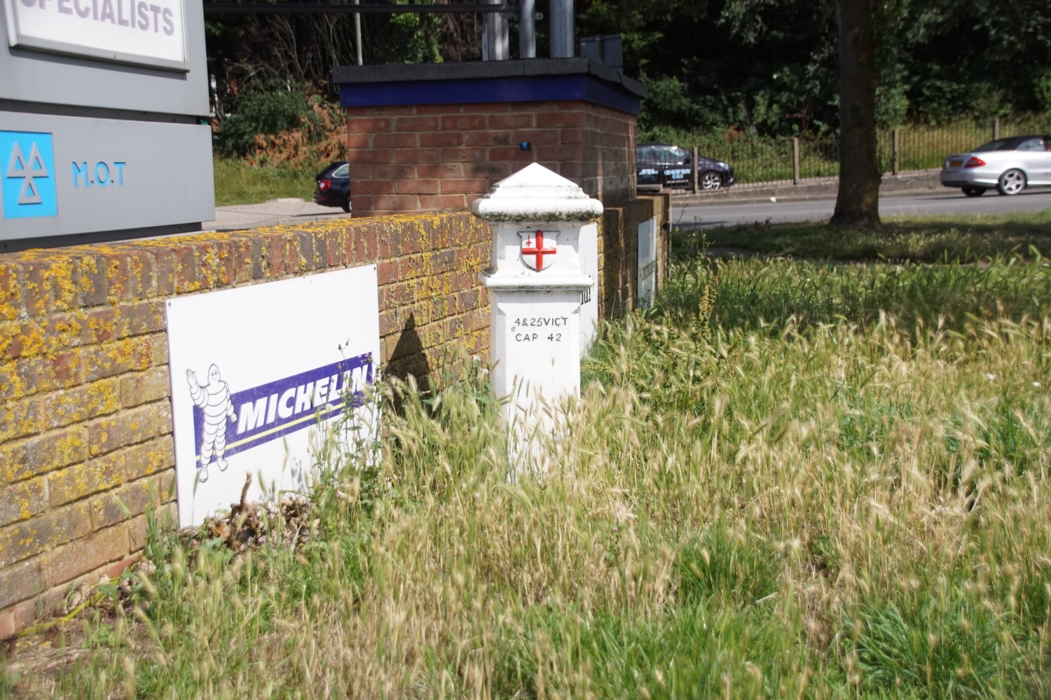
List Entry Number: 1261609 Heritage Category: Listing Grade: II Location: COAL TAXPOST OUTSIDE THE CENTRAL SERVICE STATION, FARNBOROUGH WAY, ORPINGTON, Bromley, Greater London Authority
COAL TAXPOST 193 OUTSIDE BAPTIST CHURCH
List Entry Number: 1299018 Heritage Category: Listing Grade: II Location: COAL TAXPOST OUTSIDE BAPTIST CHURCH, HIGH STREET, GREEN STREET GREEN, ORPINGTON, Bromley, Greater London Authority
COAL TAXPOST 194 AT JUNCTION WITH FARNBOROUGH HILL
List Entry Number: 1261585 Heritage Category: Listing Grade: II Location: COAL TAXPOST AT JUNCTION WITH FARNBOROUGH HILL, SEVENOAKS ROAD, ORPINGTON, Bromley, Greater London Authority
COAL TAXPOST 195 AT JUNCTION WITH WARREN ROAD
List Entry Number: 1186818 Heritage Category: Listing Grade: II Location: COAL TAXPOST AT JUNCTION WITH WARREN ROAD, SEVENOAKS ROAD, ORPINGTON, Bromley, Greater London Authority
The last of these has a slightly misleading description as the post is actually at the start of Shire Lane, the other side of Sevenoaks Road from Warren Road.
About Coaltax Posts
Coal
imported into the City of London had been taxed since medieval times
and, as it was originally all brought by sea to riverside wharfs, the
collection of the duties was relatively easy. The city is a small (one
square mile) but influential and rich part of London. The Port of
London, within which the duties were payable, stretched far beyond the
boundaries of the City, all the way along the Thames from Yantlet Creek
(downstream from Gravesend) to Staines.
By the 19th century, however, there was increasing trade by canal and rail, and various Acts of Parliament extended the catchment area to include these new modes of transport. In 1845 the boundary was set at a radius of 20 miles from the General Post Office, London, from Langley in the west to Gravesend in the east and from Ware in the north to Redhill in the south. In 1851 an Act permitted the erection of boundary markers to indicate where this boundary lay; and about fifty markers, inscribed with a reference to the Act, were erected.
In 1861 a further Act – the London Coal and Wine Duties Continuance Act – was passed, reducing the area to that of the Metropolitan Police District plus the City of London. This stretched from Colnbrook in the west to Crayford Ness, at the mouth of the River Darent, in the east, and from Wormley, Hertfordshire in the north to Banstead Heath, Surrey in the south.
The purpose of the posts was to give notice of where the boundary ran so that no-one could claim ignorance of liability to pay the duties. However in general, duties were not actually collected on the boundary. The one known exception was the Grand Junction Canal: originally customs officers collected the duties at Grove Park, Hertfordshire. After the boundary was changed in 1861 a permanent house for the collector was built at Stockers Lock near Rickmansworth. See Photo
In other cases the railway and canal companies or local coal merchants calculated the sums due and paid the money to the Corporation. The railway companies were initially allowed some coal free of duty for their engines.
By the 19th century, however, there was increasing trade by canal and rail, and various Acts of Parliament extended the catchment area to include these new modes of transport. In 1845 the boundary was set at a radius of 20 miles from the General Post Office, London, from Langley in the west to Gravesend in the east and from Ware in the north to Redhill in the south. In 1851 an Act permitted the erection of boundary markers to indicate where this boundary lay; and about fifty markers, inscribed with a reference to the Act, were erected.
In 1861 a further Act – the London Coal and Wine Duties Continuance Act – was passed, reducing the area to that of the Metropolitan Police District plus the City of London. This stretched from Colnbrook in the west to Crayford Ness, at the mouth of the River Darent, in the east, and from Wormley, Hertfordshire in the north to Banstead Heath, Surrey in the south.
 |
New marker posts (about 280) were
erected to show the boundary within which the duty was payable. These
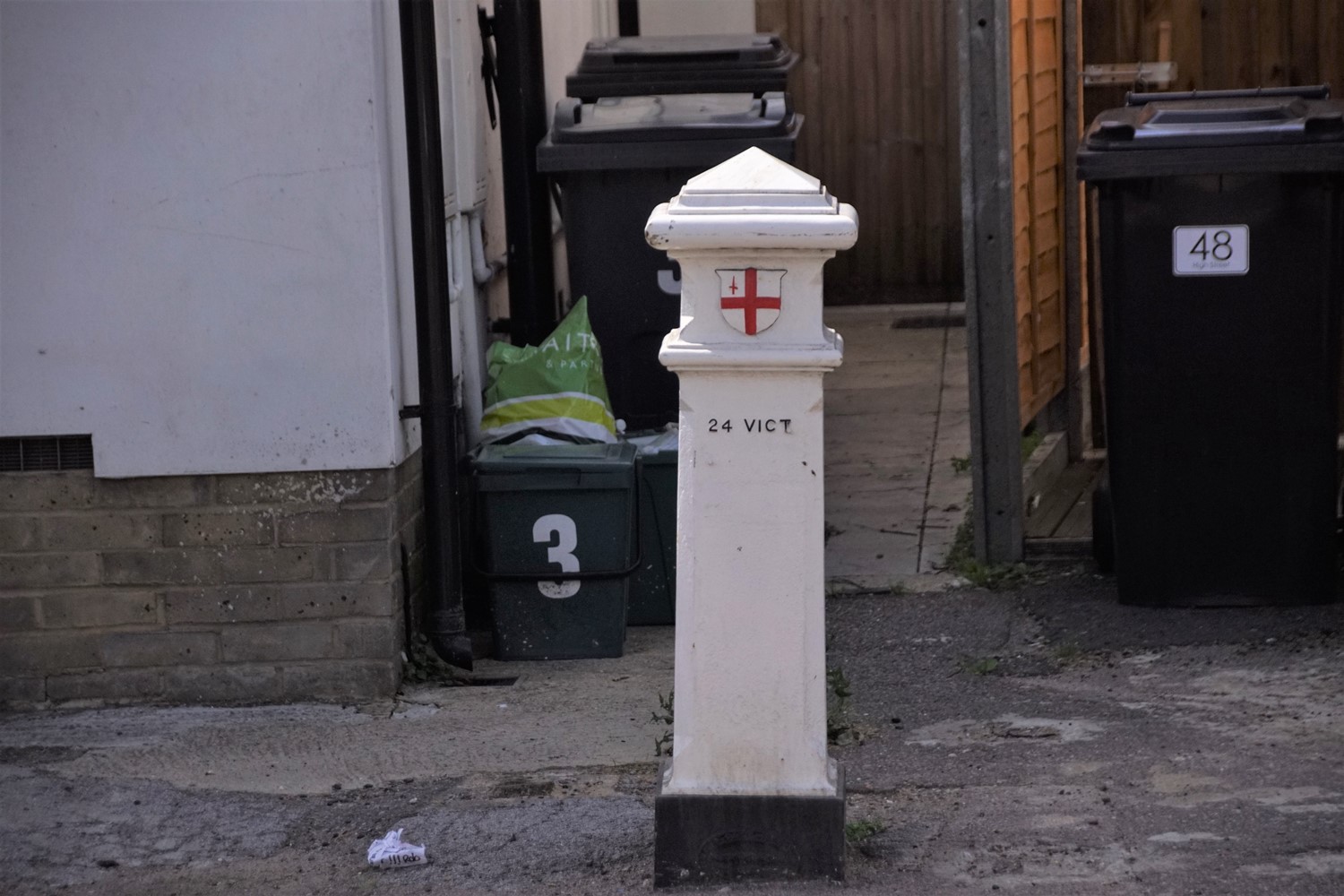
again cite the Act by regnal year and chapter number, i.e. 24 & 25 VICT
CAP 42. In some cases, notably on railways and canals, markers made for
earlier acts were reused on the new boundary. Most (over 200) of these
posts survive. Although the title of the Act refers to wine duties, these were collected only in the Port of London: the boundary marks have no connection with the wine duties and it is incorrect to call them "coal and wine duty posts". |
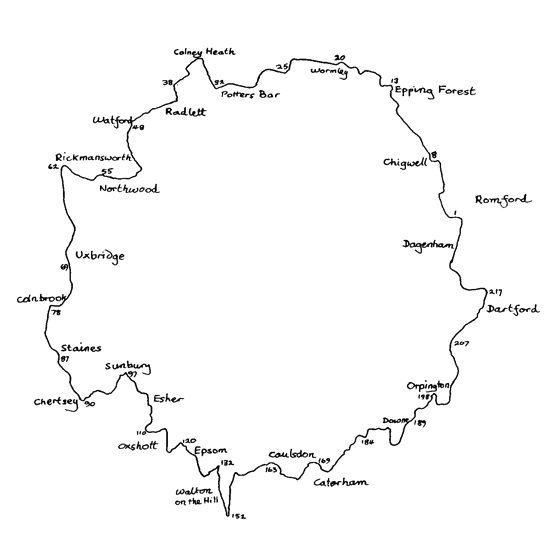
| Map showing selected Coaltax posts round London, Click to enlarge |
The purpose of the posts was to give notice of where the boundary ran so that no-one could claim ignorance of liability to pay the duties. However in general, duties were not actually collected on the boundary. The one known exception was the Grand Junction Canal: originally customs officers collected the duties at Grove Park, Hertfordshire. After the boundary was changed in 1861 a permanent house for the collector was built at Stockers Lock near Rickmansworth. See Photo
In other cases the railway and canal companies or local coal merchants calculated the sums due and paid the money to the Corporation. The railway companies were initially allowed some coal free of duty for their engines.
Nick Reynolds
TRANSPORT
About Milestones
The Romans laid good metalled roads to move soldiers and supplies quickly across their Empire: they measured distance to aid timing and efficiency, possibly marking every thousandth double-step with a large cylindrical stone. 117 still survive in the UK.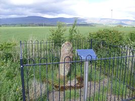
Roman Milestone, Cumbria
The Latin for thousand was ‘mille’ and the distance was 1618 yards; the eventual British standard mile was 1760 yards, although ‘long’ miles also existed into the 19th century.
After Roman times, roads developed to meet local community needs: in 1555, an Act of Parliament made local parishes (or often townships in the North) responsible for their upkeep and boundary markers became important. In 1697, the Justices were ordered to erect guideposts at cross-highways and on the moors. At this time, travel by road was slow and difficult. The sunken lanes became quagmires in wet weather and occasionally both horses and riders were drowned. It took 16 days to cover the 400 miles from London to Edinburgh.
So Turnpike Trusts were set up, by Acts of Parliament, from 1706 to the 1840s. Groups of local worthies raised money to build stretches of road and then charged the users tolls to pay for it. The name ‘turnpike’ comes from the spiked barrier at the Toll Gate or Booth. The poor bitterly resented having to pay to use the roads and there were anti-turnpike riots.
From 1767, mileposts were compulsory on all turnpikes, not only to inform travellers of direction and distances, but to help coaches keep to schedule and for charging for changes of horses at the coaching inns. The distances were also used to calculate postal charges before the uniform postal rate was introduced in 1840. At the height of the turnpike era, there were 20,000 miles of roads with milestones.
From the 1840s, rail travel overtook road for longer journeys and many turnpike trusts were wound up. In 1888, the new County Councils were given responsibility for main roads and rural district councils for minor routes. As faster motorised transport developed so the importance of the milestones waned.
‘Milestone’ is a generic term, including mileposts made of cast iron. Such waymarkers are fast disappearing; around 9000 are thought to survive in the UK. Most were removed or defaced in World War II to baffle potential German invaders and not all were replaced afterwards. Many have been demolished as roads have been widened, or have been victims of collision damage, or have been smashed by hedge-cutters or flails.